|
A
Visit to Ireland's Wild Wicklow
|
 |
Wild Wicklow
Written by
Rick Archer
November 2013
Marla and I
visited the Wicklow Mountain area near Dublin, Ireland, during our Oslo 2010
Cruise.
I suppose
it is rather odd to be writing a travelogue on a trip we took three
years ago. However, after writing a story about the
Loch Ness Monster last week, I
thought it would be fun to add another Chapter to the saga of the Oslo
2010 Cruise.
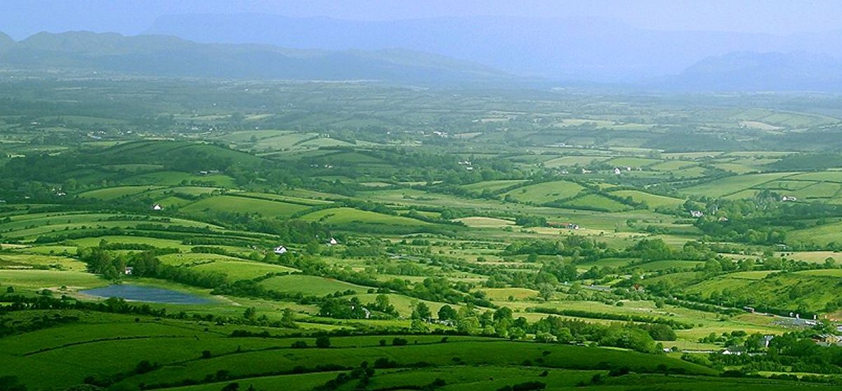
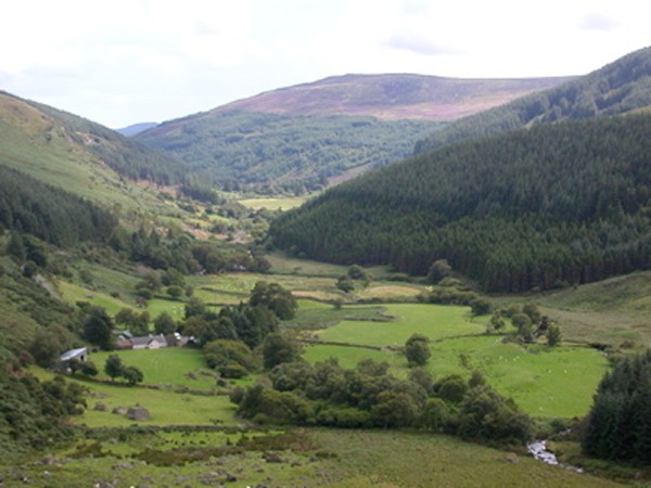
If I had to
describe Ireland in one word, that word would be certainly be "Green". I
have never seen a more lush landscape in all my life. In
addition, the yellow gorse was in full bloom during our
visit. The mountains,
the forests, and the vast fields full of yellow gorse made for truly
spectacular vistas.
|
 |
|
 |
|
The
Countryside of Wild Wicklow
|
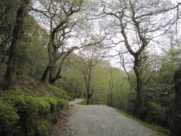
Our
Cruise stop in Dublin, Ireland, was our third port of
call on the Oslo trip. Previously we had been to
Paris
and to
Normandy,
the landing point for D-Day, 1944.
Marla had researched Ireland thoroughly.
She had discovered every
tour guide highly recommended an area south of Dublin known as "Wild
Wicklow", a mountainous terrain known for its forests,
rugged hills, and beautiful countryside.
Practically from the moment we left Dublin, our mouths
dropped open at the spectacular scenery. For people
like me used to the flat and utterly boring terrain
between Houston and San Antonio here in Texas, these vast rolling
fields of green were breathtaking to say the least.
Unfortunately, the bus never stopped to allow me to take any
pictures. That's a real shame because the fields and
valleys are indeed endless, vast, and inspiring.
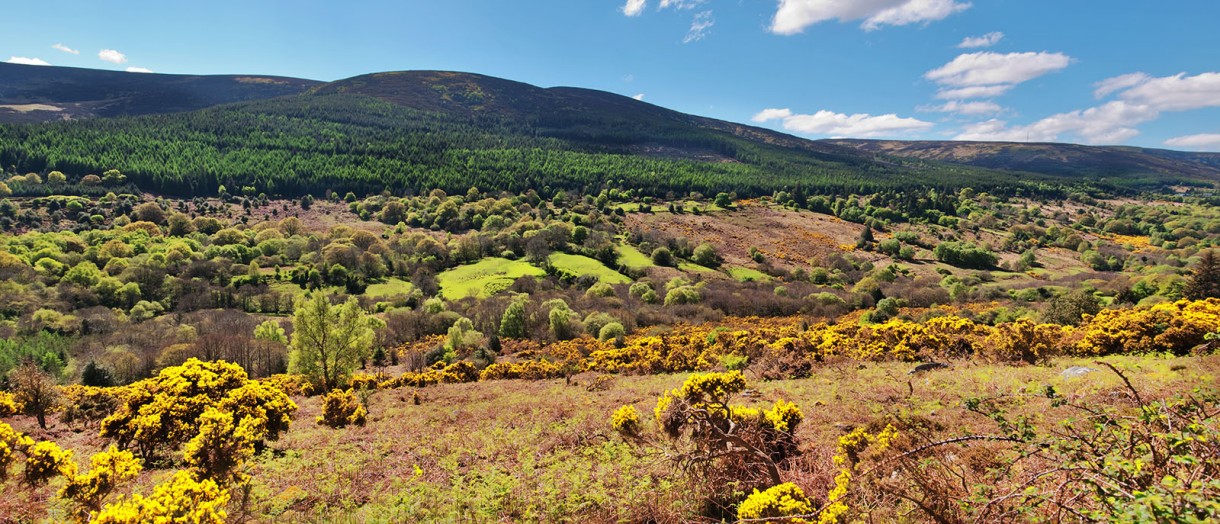
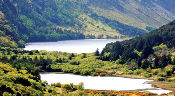
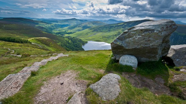
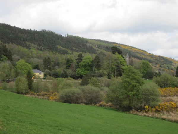
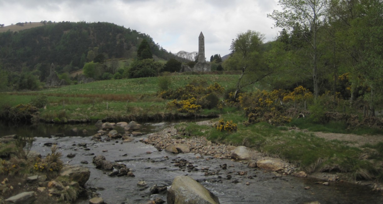
The
picture at right is one I found on the Internet that is
representative of the panoramic nature of the area leading
up to the Wicklow Mountains. However, this picture
just barely does justice to the scenery. Someday you
have to see it for yourself.
The main
destination of our trip was Glendalough, a retreat
hidden deep within the forest in the heart of Wicklow
Mountains National Park.
"Glen" is the
Gaelic word for "valley" and "Lough" is the
Gaelic word for "lake". If you have read my
Loch Ness
Monster story, you will recall "loch" is the Scottish word for lake.
Now compare the two words: "lough" and "loch". They
are pronounced the same way, just spelled a bit different.
Loch... Lough...
Lake. Got it. Therefore the name 'Glendalough' is Gaelic for "glen of of the two lakes".
Indeed not far from the settlement are two very lovely
mountain lakes.
Glendalough was
an early medieval monastic settlement founded in the 6th
century by St Kevin, a hermit priest. St. Kevin came
to the area in search of solitude and piety. He definitely
came to the right place. Even today, this area is
completely removed from mainstream civilization.
Kevin lived for
some years as a recluse. He wandered the forests and
the mountains and used a little cave for shelter.
The
cave, now known as "St. Kevin's Bed", is well-known to the
locals. It is located in the rock face overhanging the
nearby Upper Lake.
After several years of meditation, Kevin felt called to
return to the world. He established a monastery and built
the first church at Glendalough in a valley half a mile east
of the two lakes. This was an advantageous location as
two different streams, one coming from the two lakes,
provided ample water supply.
The first church was a simple wooden
structure, but it was later rebuilt out of stone which
explains why it is known as the 'Church of the Rock'.
The monastery soon expanded and grew famous. As one of
the leading religious centers not just in Ireland, but all of Europe, pilgrims
came from far and wide to worship.
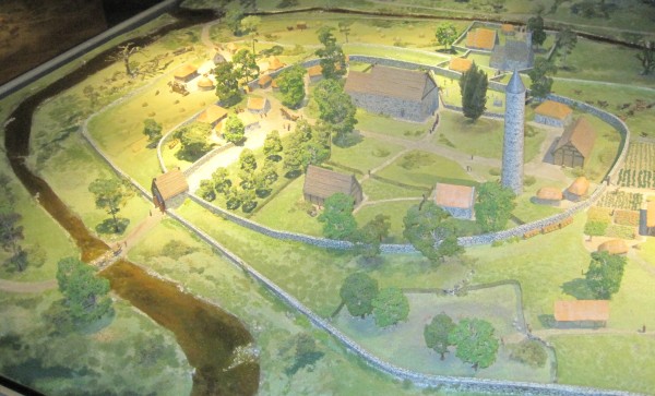
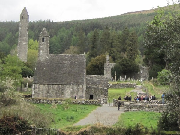
Today the remains of seven churches can be seen as well as a
medieval cathedral and the imposing Round Tower.
The drawing on
the right gives us an idea what the settlement looked like
15 centuries earlier. That was quite some time ago!
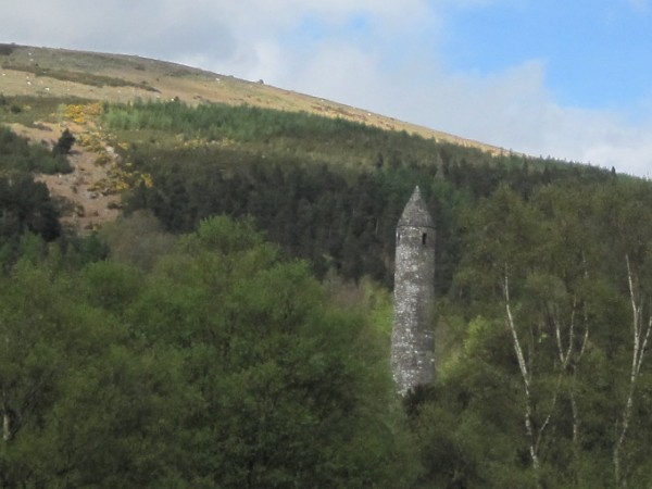
Without
question, the most impressive part of the Glendalough
monastery is the Round Tower. Jutting 100
feet into the air, this giant structure can be seen for miles.
In the olden
days, during peaceful times the Tower was used to store grain and
food supplies. In times of war, it served as a place
of refuge for the women and children during an attack.
Unfortunately,
that Tower got plenty of use. This area was first
settled by the Celts, but the Vikings arrived in 795 AD, two
hundred years after St. Kevin founded the monastery.
That is when all hell broke loose. At first all the
intruders did was plunder the countryside and leave, but
later forays brought a change of heart. That's when
some of the Vikings decided to stay awhile. Today a
great deal of Viking blood runs through the veins of the
people who reside in the Wicklow area.
The Vikings were
not the only problem. So were the English. Unfortunately,
the settlement was partially destroyed in 1398 by English
troops.
Although much of
the stonework is still in disarray, in recent times certain
parts of the settlement such as the ancient cathedral known
as St. Kevin's Church and the Round Tower have been
restored to their former beauty.
|
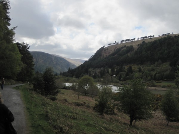
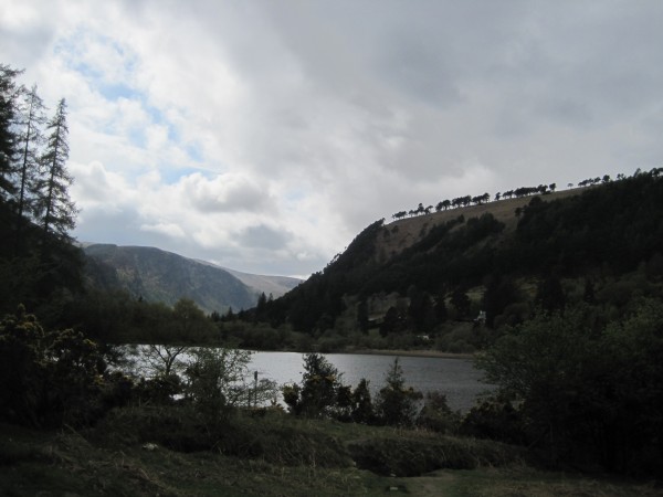
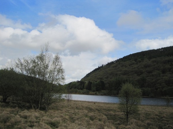
The endless
rolling fields of Wild Wicklow
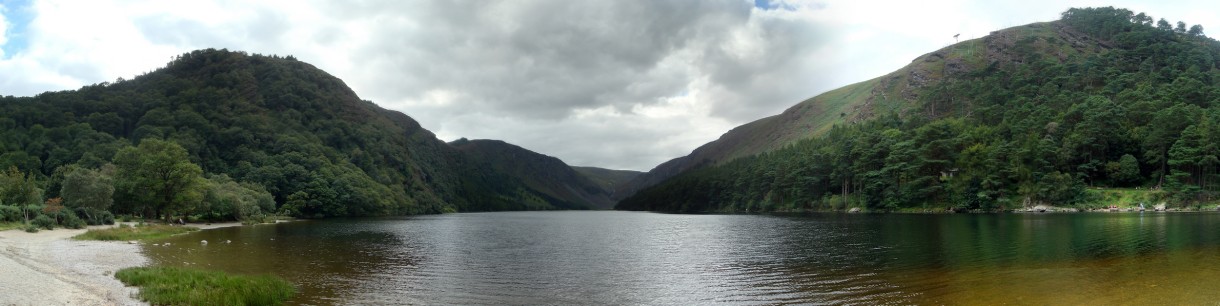
The Two Lakes of
Glendalough
As the picture
indicates, the settlement is built
right into the curve of a nearby stream.
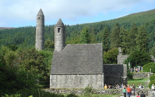
The Round Tower
and St. Kevin's Church |
|
|
|
|
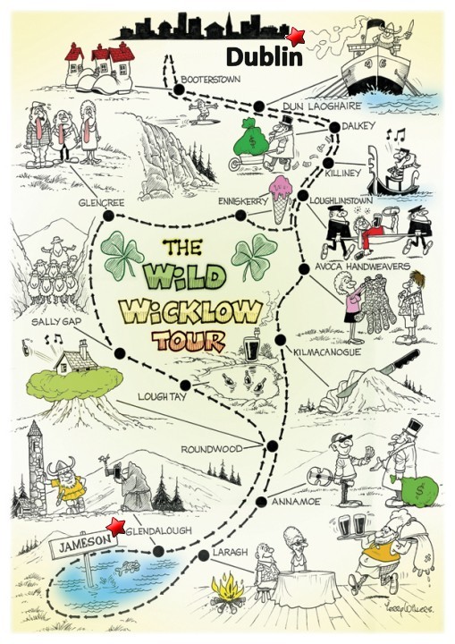
The Wicklow Way |
 |
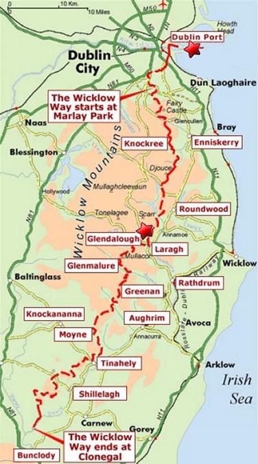 |
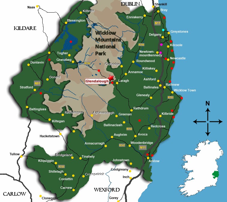
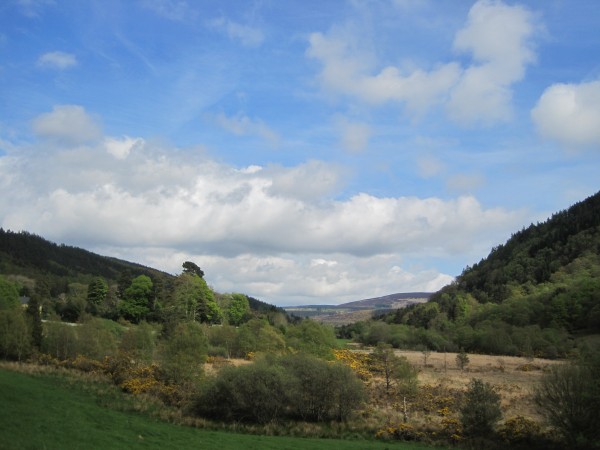
The Wicklow Way is an
80 mile long-distance trail that
crosses the Wicklow Mountains in Ireland. Unlike
America's rugged Rocky Mountains, much of the Wicklow
Mountains are lower and far smoother. Climbing is
unnecessary. They are fairly easy to walk across.
The trail runs
from Marlay Park in the southern suburbs of Dublin
and winds throughout
County Wicklow. The trail
ends in the village of Clonegal in County Carlow.
(see map above)
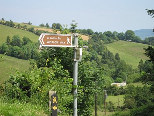
Wicklow Way
is designated as a National Trail. It
is marked by easily-seen
posts with a yellow "walking man" symbol and a directional
arrow. Typically completed in 5�7 days, it is one of the
busiest of Ireland's National Waymarked Trails.
Up to
24,000 people a year cross the most popular sections. The
Wicklow Way is also used
regularly by a number of mountain running competitions.
The trail follows forest tracks, mountain paths,
and narrow, seldom-used country roads known as 'boreens'.
Mountains, upland lakes and steep-sided glacial
valleys make up the terrain of the initial northern sections
of the Way before giving way to gentler rolling foothills in
the latter southern sections.
The Wicklow
Way passes straight through
Glendalough. In fact,
the walk known as "Glendalough
to Glenmalure"
is considered the most popular stretch of
the entire trail. This picturesque adventure covers a
distance of 9 miles.
Walking time typically takes about 4 1/2
hours to complete... a good afternoon effort.
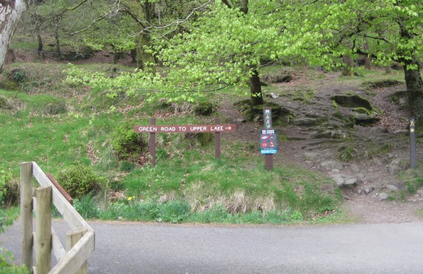
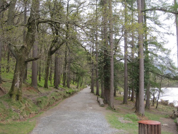
If one prefers
to stick around Glendalough, there are many walking trails
nearby of varying difficulty. Within the valley itself there are
nine color-coded walking trails maintained by Wicklow
Mountains National Park.
Each trail
begins at an information office located near the Upper
Lake (pictured below) where maps are available to
purchase.
Those who have the time to spare
could easily spend an
entire day walking and exploring the Glendalough area
as it has much to offer both scenically and historically.
|
 |
 |
|
|
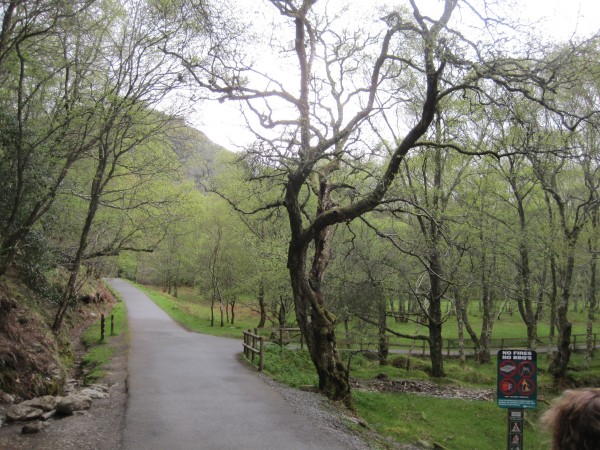
Rick and Marla's Walk Through
the Woods |
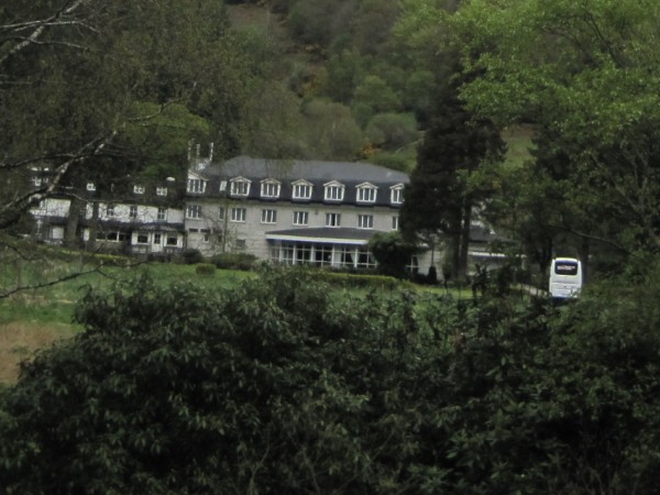
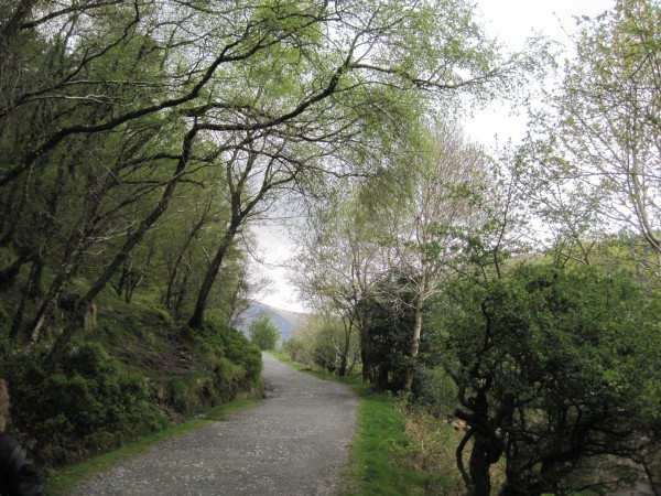
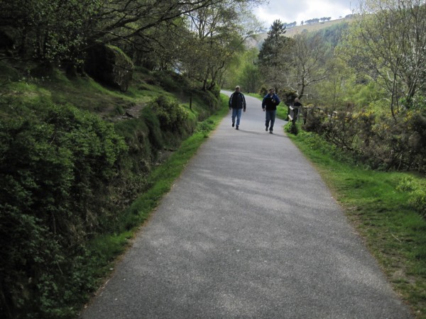
After our
amazing bus ride through the
scenic Wild Wicklow area, we
finally arrived at Glendalough. I remember there
were a dozen of us from the SSQQ Travel group. We began our
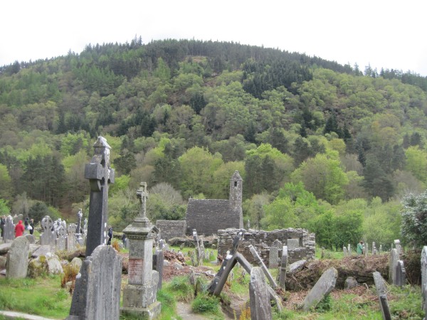
tour of the monastery with a walk through the cemetery.
If you look, you
can spot St. Kevin's Church
in the background. That is where our guide led us and
began a lengthy lecture.
I have to be
honest. While some people in our group were clearly
fascinated by the history of the monastery, Marla and I had our eyes
focused on that heavily forested hill in the background.
Our guide had
let it slip that there was an amazing walking trail that led
to two beautiful lakes about a mile away. His second
mistake was pointing in the right direction.
Marla and I
instantly glanced at each other and nodded. We wanted
to take that walk for sure.
There was only
one problem. Our guide liked to talk... and talk...
and talk some more. We were chomping at the bit.
Time's a wastin'! If we politely
stuck around and continued to listen to this guy, our spare
time to see the lake would be diminished.
So Marla and I
quietly drifted to the rear of our group.
Unfortunately
just about the time we were going to disappear behind a wall
and make our escape, our movements were spotted by some of
the people in our group. They immediately frowned at
us. What are Rick and Marla up to now?
Seeing their
looks of disapproval, Marla and I both froze. How
were we going to ditch the guide without drawing notice from
our suspicious companions?
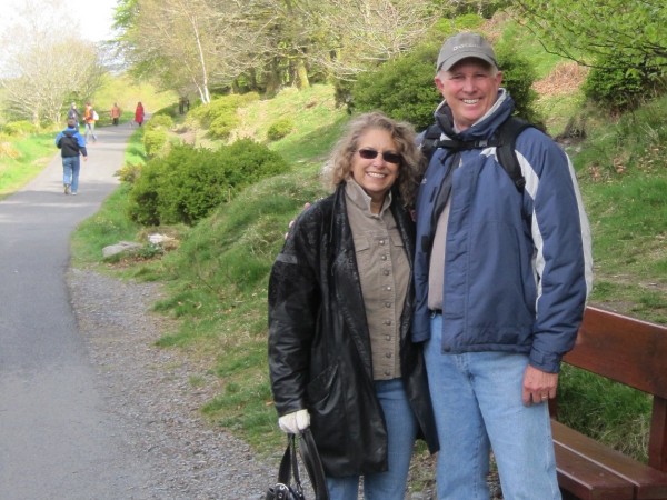
We needed a
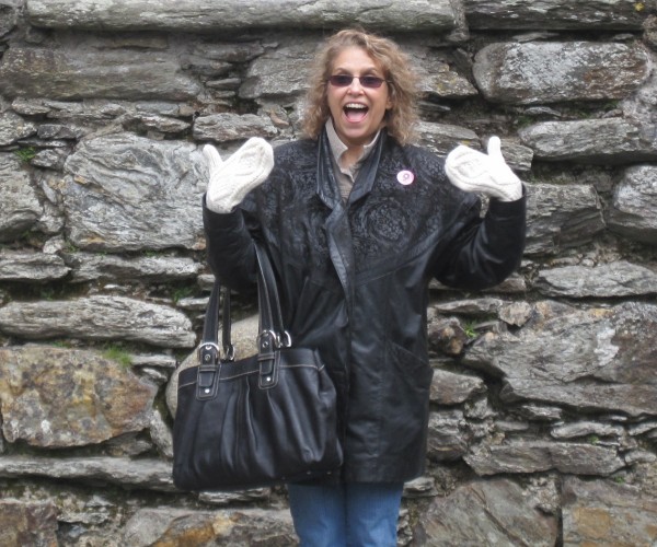
ruse. So I began to take a series of pictures of
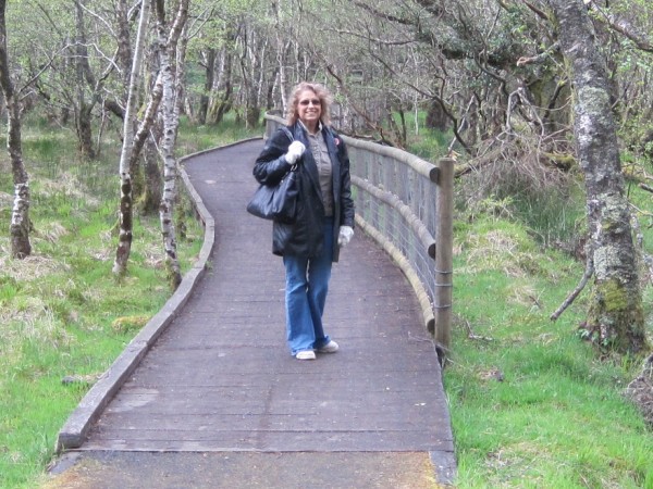
Marla. As one can see, Marla put on a good show.
Marla's inner
ham came out and I dutifully snapped away.
Our trick worked
like a charm. Once our supervisors realized we were simply
attempting to take
pictures, our movements were no longer interesting. So
our companions returned their attention to the talkative
guide.
The moment our
friends turned their backs to us, we made our move.
Seconds later we were behind the same wall that we had used as
the background for Marla's photograph.
We were now free
to begin our walk. And off we went!!
|
 |
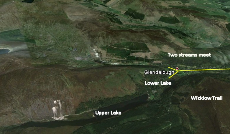
As this map
taken from Google Earth indicates, Glendalough
resides in a valley where two streams separated by a mountain
finally come together.
We did not have
the energy to climb to the top of the large hill to find the
Wicklow Trail above. Instead we found a perfectly wonderful
walking trail at the base of the hill. We immediately began
to walk in the direction of the lake.
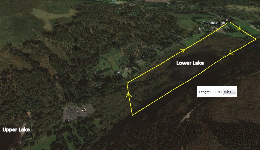
Google Earth
has a ruler function. I was surprised to find what I thought
was a very long walk was really only 1 1/2 miles.
Our problem was
that we only had 45 minutes for our walk. Dublin
was 30 miles away which meant an hour of driving.
The
driver had made it clear he wanted to get us back with
plenty of time to explore the shops of Dublin.
|
 |
Consequently we
were very unsure how far we could walk and still have enough
time to get back to the bus at the stated time.
No matter, we did okay. We circled the Lower Lake.
Plus we were able to get far enough to see the Upper Lake
in the distance. At that point we chose to head back
rather than risk being late.
I think we would
have made better progress if I hadn't stopped every ten feet
to take another picture. So why did I take so
many pictures? In truth, I wanted to preserve my memory of a
truly beautiful area.
Trust me, St.
Kevin chose well. This remote corner of the Earth was
indeed the very definition of peace and solitude. It
was also kind of lonely, especially with the gray skies and
the looming mountains.
|
 |
In order to
sneak away, we had to pass some of the buildings that form
the village which surrounds the monastery ruins.
Glendalough is largely dependent on a thriving tourist
industry.
|
Here is the same
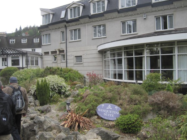
building as we put some distance in. I think it is a
hotel. I can easily imagine people coming here for
weddings. It would a lovely place to get married.
|
This building is
the Information Center for the monastery.
In addition, I have a strong hunch this building is also
where one would go to get a map listing the trails of
Glendalough. I am certain one can access the nearby
Wicklow Way from this place.
|
Aha. Just
the sign we wanted to see.
|
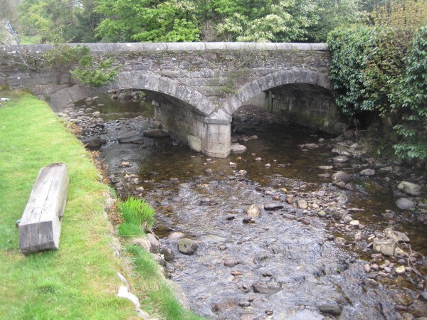
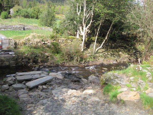
First we had to
cross this bridge.
|
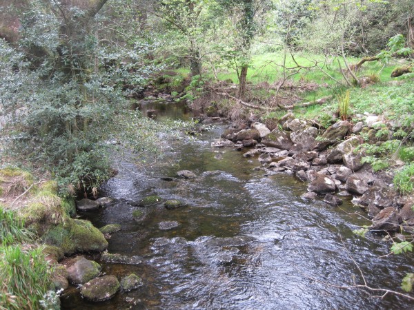
The first leg of
our walk paralleled this stream which connected to the Lower
Lake about 400 yards ahead.
|
As we walked
along the path which paralleled the stream, Marla and I
gasped. Good grief, that was our group! We had
been walking for over ten minutes only to find everyone was
still stuck in the same spot listening to that guide drone
on and on. Maybe it was rude, but we had done our best to
leave discretely. One thing for sure - We didn't feel
guilty. We've learned our lesson. When you have
a limited amount of time, follow your instincts and do what
you want to on these trips.
|
One time we were
in Palermo, Sicily. The guide saw a painting of fruit
and began identifying the name of each fruit. Marla
and I split after one minute. We walked back to the
ship, beating our own group by half an hour and getting
great exercise in the process. That night Marla's poor
brother Neil complained he had been forced to stand there
listening to the guide name apples and oranges for 10
minutes! Neil added he already knew what a banana
looked like.
|
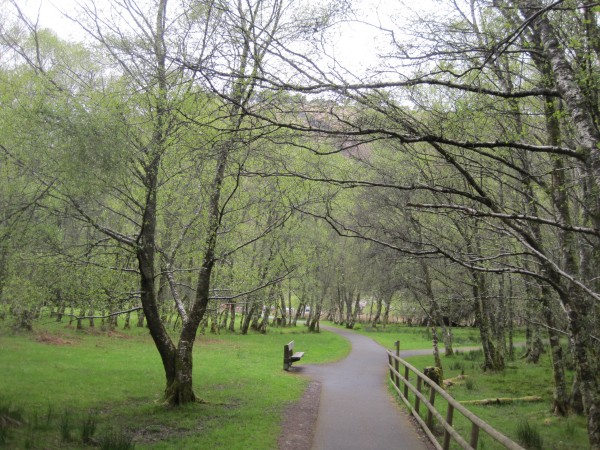
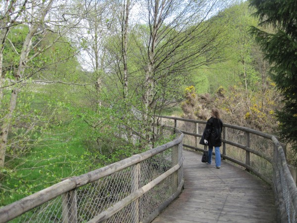
As one can see,
we found a terrific walkway. On our left was the
large hill. On our right was the stream about 10 feet
below.
|
Here is a look
at the view to our left.
|
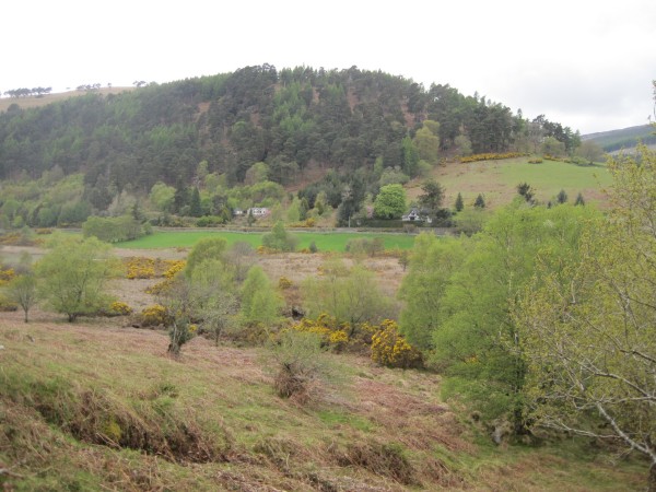
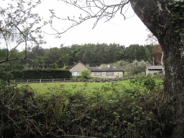
Take note of
those two homes on the other side of the valley. We
passed very close to them on our way back. There was so
much beauty to appreciate. In every direction I
looked, there
was something interesting to behold.
|
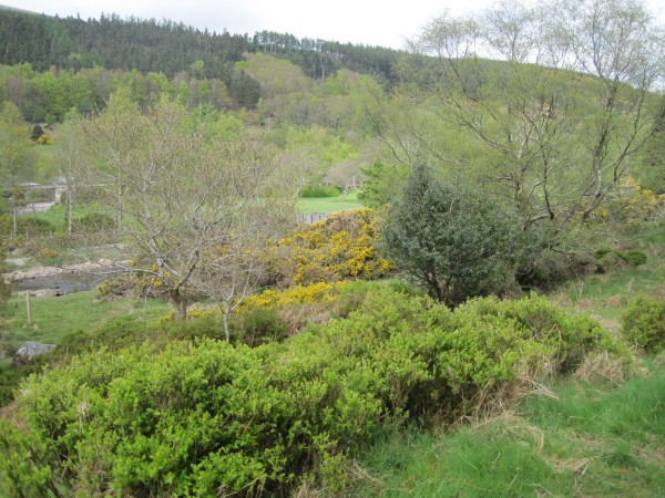
The path
continues. Here we get our first glimpse of the Lower
Lake on our right.
|
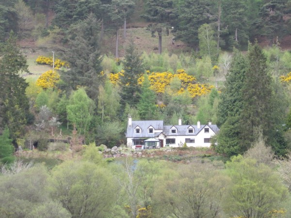
I used the
camera zoom feature to get a better picture of the two homes in the
distance. That yellow gorse was so pretty.
|
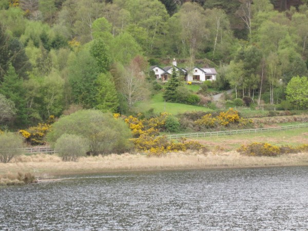
This entire area
was postcard perfect. Marla was falling apart.
Her dream is to have a cottage on a lake. Seeing her
fantasy home in the flesh was more than she could stand.
|
Looking back,
there is the Round Tower behind us. Those people are from
another group. We had just passed them.
|
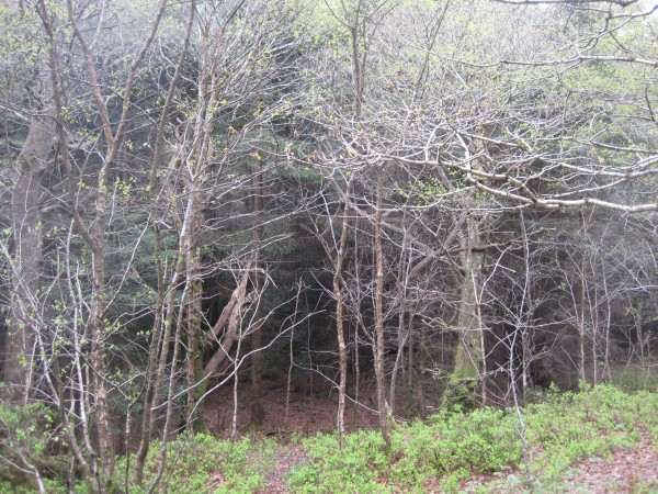
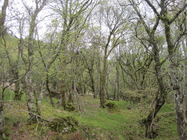
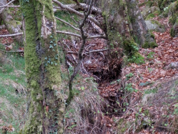
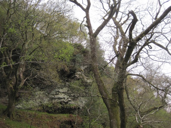
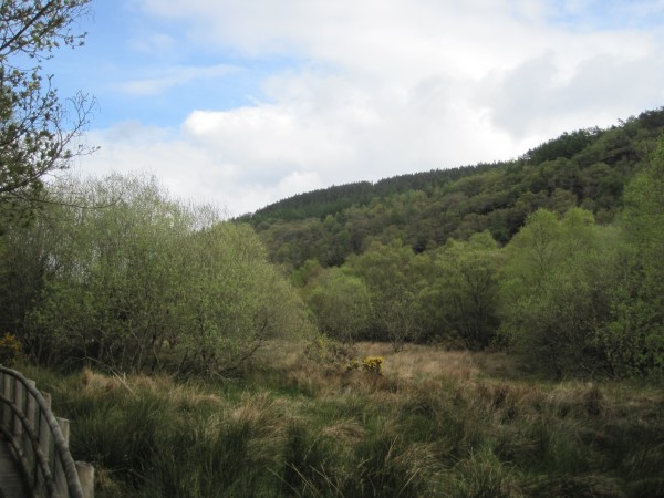
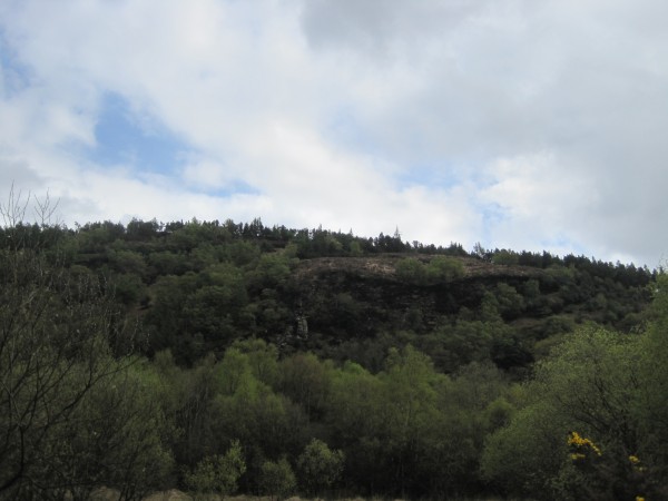
More of the
forest covering the hill on our left. We visited in
May 2010. Note the springtime leaves just coming in.
|
Our pathway
continues. We are gaining elevation.
|
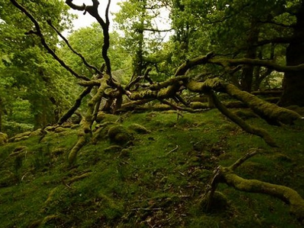
The moss-covered
vegetation was stunning. Truth be told, this area was
truly idyllic. I believe Glendalough ranks as
Ireland's very own Garden of Eden.
|
Moss, lichen, ivy,
vines, and leaves!! Alas, it was all much too pretty for me.
I am huge fan of the forest.
|
Thank goodness
there was no pathway up the hill or I would have been sorely
tempted to take it.
|
Now we came to
something interesting. We caught a glimpse of the edge of
the Upper Lake up ahead.
|
However, before we
could
reach the lake, something new caught our eye.
|
The trail dipped
down and we lost sight of the Upper Lake which was surely
just a few hundred yards up ahead behind those trees.
This turn-off forced us to stop and think things over.
Unfortunately there were no direction signs to help us with our
decision.
|
Should we go
straight ahead and see the Upper Lake up close? If so, would
we have enough time to retrace our steps and get back in
time? Or should we take this inviting path?
Our big question was whether it would lead us back to the
Information Center where our bus was located.
|
As the reader
can guess, we decided to turn right and take our chances
that the path made a complete loop back. We chose to
turn back based on the fact that it had taken us 22 minutes
to get this far. That gave us 23 minutes to return to the
bus.
|
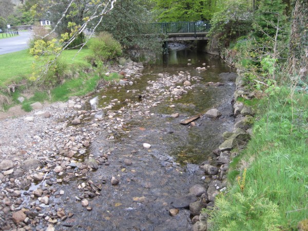
Now we crossed a
bridge that took us over the same stream which had kept us company during
the first leg of the walk. However, this time the
stream was connecting the Upper Lake to the Lower Lake.
|
The right turn
in the trail
led us to the other side of the valley.
|
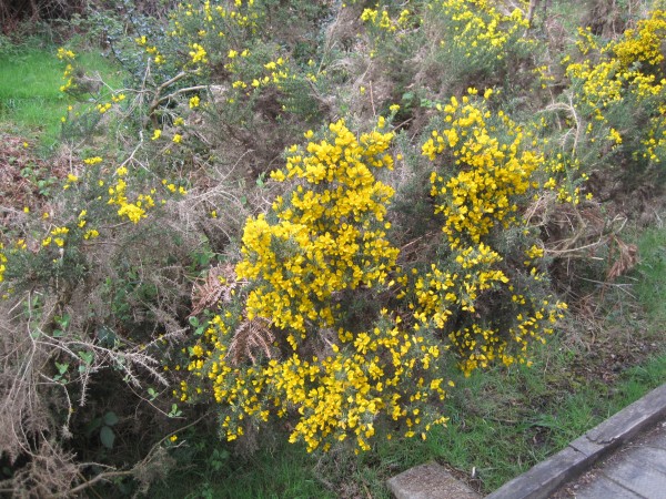
More gorse of
course.
|
To our relief,
the path did lead back to the bus. We estimated the Round Tower
was a mile away, but it was actually closer.
|
Now that we were
down in the valley, we discovered a second stream coming from
another direction.
|
Have you noticed
a single thing to ruin these pictures? No. Nor
did I have to crop anything out. The view in every
direction was stunning. These settings were
completely natural.
|
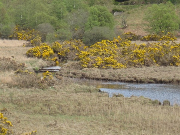
These ducks were
walking in a field right beside the new stream. We were
crossing through a wetlands area.
|
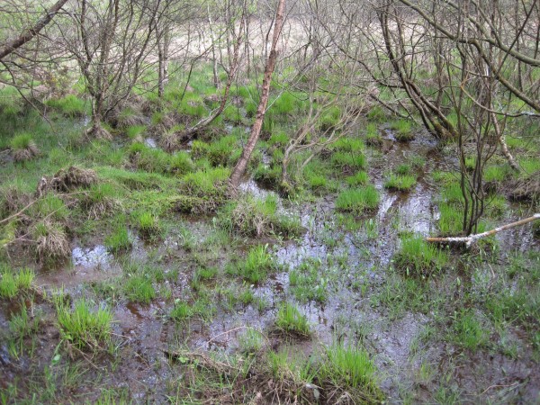
As our walk took
us to the other side of the valley, we encountered a marsh.
|
Consequently we
walked for some time on a lovely elevated walkway complete
with railing.
|
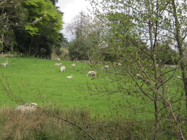
Nearby were
grazing sheep. Boy, did they make a lot of noise!
|
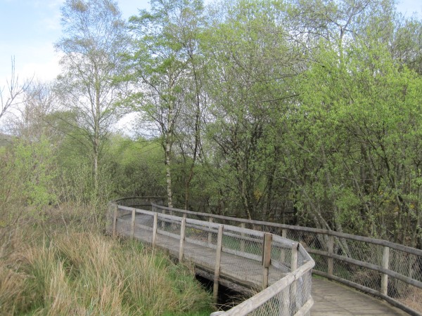
Notice the
walkway was elevated by at least four feet. Obviously
this area floods during the rainy season.
|
From what I
gather, the glacier-formed valley of Glendalough is the
meeting place for two rivers separated by the mountain on
the right.
|
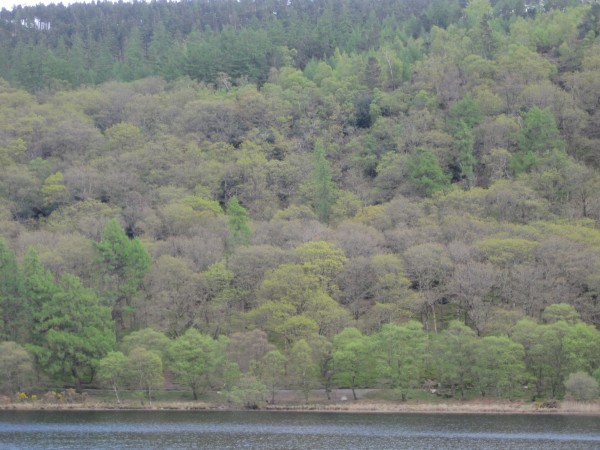
Here we are
passing the Lower Lake on our way back. Here is a
look at the forest covering the side of the large hill we
saw from the cemetery. The walkway we used on the
first leg of our walk can be seen about ten feet above the
waterline.
|
Have you ever
heard the song "The Rocky Road to Dublin"?
Judging from that sheep enclosure, rocks are plentiful in Ireland.
|
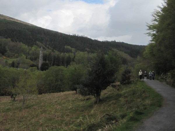
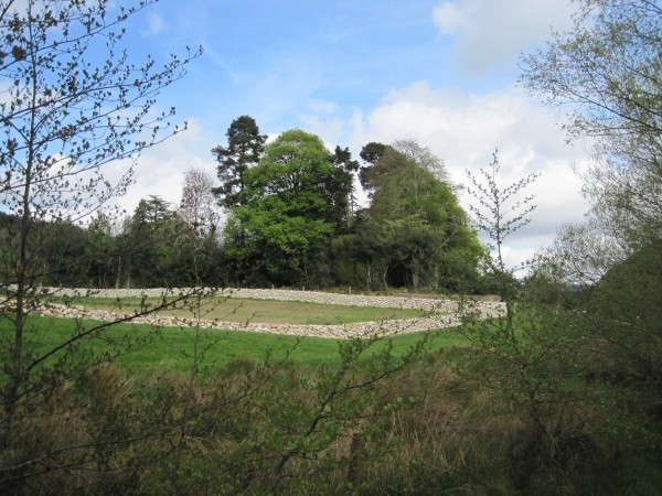
Everywhere we
went, there was another fence made out of rocks. I
would imagine those fences last a long long time.
|
Wherever we
went, we were never in danger of getting lost thanks to the
giant Round Tower in the distance.
|
We passed way
too close to another pretty cottage overlooking the lake.
I could see Marla's eyes narrow and her face grow taut as
waves of
envy swept through her mind.
|
I never knew
there were so many different shades of green until today.
|
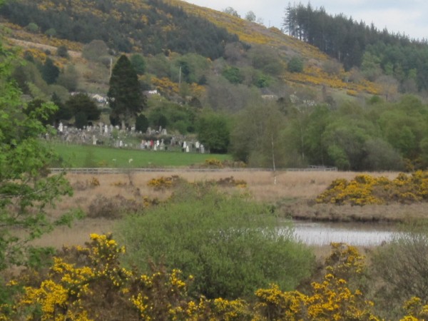
Up ahead we
spotted the cemetery where we had first entered the
Monastery compound. We were close to the end.
|
Up ahead I saw
two men running towards us.
|
One of the men
turned out to be our friend Bill Shaw. He stopped to greet
us and explained he had been running to make
up for lost time. He too wanted to see the lakes and
the rest of the area with the little remaining time.
|
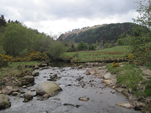
Right before the
end of our walk, I made a fun discovery. Here is the
meeting point of the two different streams.
Without question, this was an exquisite walk.
It will always stand as one of our favorite
walks that Marla and I have taken during our many cruise
adventures.
|
Now that our
journey was over, I took one last look at the giant hill
overlooking the monastery. I strongly suspect the
Wicklow Way Trail crosses the top of that hill.
Marla and I agreed Glendalough would be a wonderful spot to
live.
I will never
forget this place. It has a real magic about it.
|
 |
| |
|
|
The Bus Ride Home |
As we headed
back to Dublin on the bus, our friend Wendy Weston
screamed in dismay. Everyone on the
bus snapped to attention. What's wrong?
Wendy was
searching
frantically for something, but what?
Finally we got Wendy to stop for a moment and explain.
Wendy moaned that she
had left her wallet back at the retreat.
Or did she?
She said she had bought something at the gift shop in the
Information Center back at Glendalough. She must have
left her wallet there. But Wendy also thought she had her
wallet with her. Wendy wasn't sure at all.
At that exact
moment, Robert Goins hopped up to help
Wendy with the
search. His decisive intervention
was critical.
Only half the people on our bus
were with the SSQQ group. I saw the
looks on their faces and it wasn't good. We were 8
minutes from the Information Center. To turn back now
would cost us at least 20-30 minutes - 8 to return, 8 to go
look, 8 to make up for lost time.
|
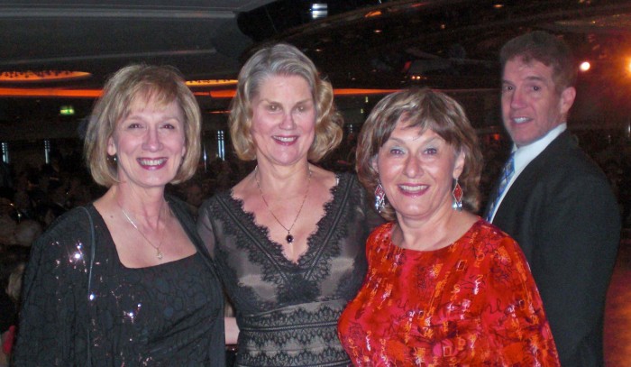
Sharon,
Wendy, Eileen, Robert |
If we went back now,
everyone's plans for Dublin would be totally destroyed. I
fully expected the other half would
conclude this was Wendy's problem and tough luck.
However, to
my delight, once they saw Robert react and then
saw Sharon and Bill and the rest of us begin looking too, they
shrugged and changed their minds.
They all agreed
to turn the bus around and head back even though this would delay
our trip at least 25 minutes. Good for
them!
The entire group got on their hands and knees
to see if the wallet had fallen on the floor. Nope. It was nowhere
in sight.
Amazingly, just as the bus began to turn around,
at that exact moment, something in the way the bus turned
revealed to Wendy that her slim wallet was
stuck between the seat
and the bus wall. Aha!
We didn't have to turn around after
all. The good deed of agreeing to turn the
bus around had magically solved the problem.
We all cheered!
What amazing luck!
And with that we were
off to the Rocky Road to Dublin.
|
 |
|
| |
|
 |
After the
celebration died down, I
was deep in thought thanks to a strange coincidence... and
coincidences always make me think.
One day earlier I
had completely fallen apart. We had visited
Omaha
Beach, the site of D-Day. Like today, I had separated from the group to
move faster. In so doing, I ended up at the Visitor's
Center by myself. As I read stories of one hero after
another who died at D-Day, I became completely
overwhelmed. Reading how these brave men had fallen
while risking
their lives was more than I could take. These men had
died so people like me could lead safe and happy
lives. The guilt brought tears to my eyes.
Out of control,
I completely lost track of the time. Meanwhile, the
guide on the bus was ready to leave me. And with good
reason - I was 20 minutes late! Eileen Kondor
stood up and said absolutely not; she would find me!! And
find me she did. Without Eileen's intervention, the
bus would have indeed left.
Two days in a
row, two us - first me, now Wendy - had lost their way.
And two days in a row, someone in our group had stepped up
to rescue us. And that is how it works on these trips
- we always look out for one another.
|
|
| |
|
|
|
Dublin,
Ireland |
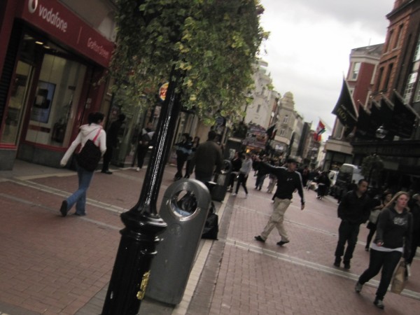
As promised, our
bus dropped us off in the heart of Dublin. The driver showed
us where the shuttle would pick us up. We had about an
hour and a half to explore the town.
|
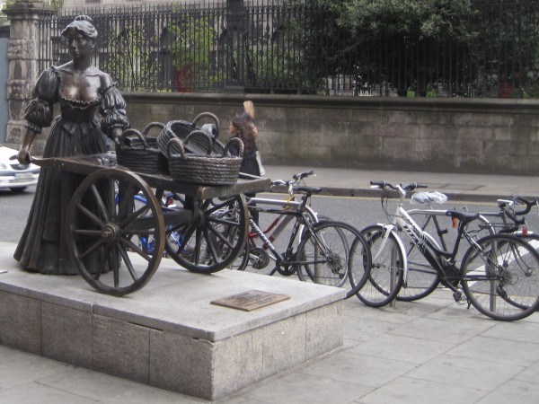
Bicycles are a
very popular form of transportation here.
|
Bill
Shaw has a considerable amount of Scottish blood flowing
through his veins. I'm not sure about Sharon, but I am
guessing some German blood. Bill loved this trip more
than anyone. To Bill, it was a visit to his ancestral
roots.
|
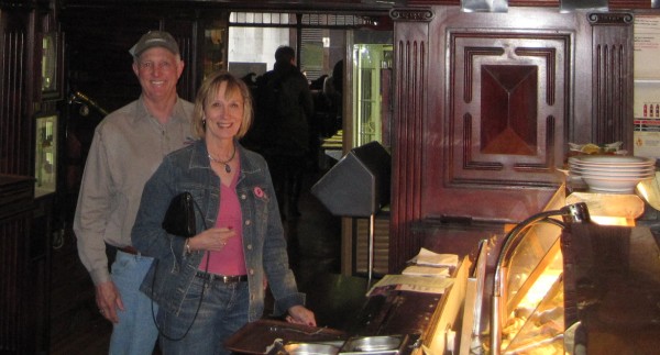
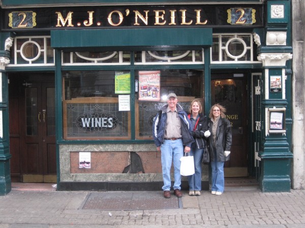
The one thing I
know for sure is that Bill researched the pubs of
Dublin. He made a beeline for O'Neills Pub, an
award-winning Irish bar conveniently located within easy
walking distance of the shuttle area.
|
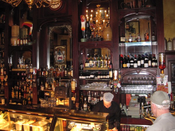
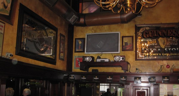
O'Neill's had
a rich atmosphere to kill for. The dark woodwork in this place was
gorgeous and the array of liquor was impressive. Marla and I had a wonderful meal complete
with Guinness Ale and fish and chips. This was the
perfect end to a perfect day.
|
Beauty,
adventure, exercise, friendship. It doesn't get any better
than this. Of course we were happy. This had
been one of the best days of our lives!!
|
|
|
|